Mapping support services for people in human mobility situations in Ecuador
GIZ + Ozifec
Team: Diana Mosquera, Francisco Gallegos, Mario Ramos, Karla Mosquera
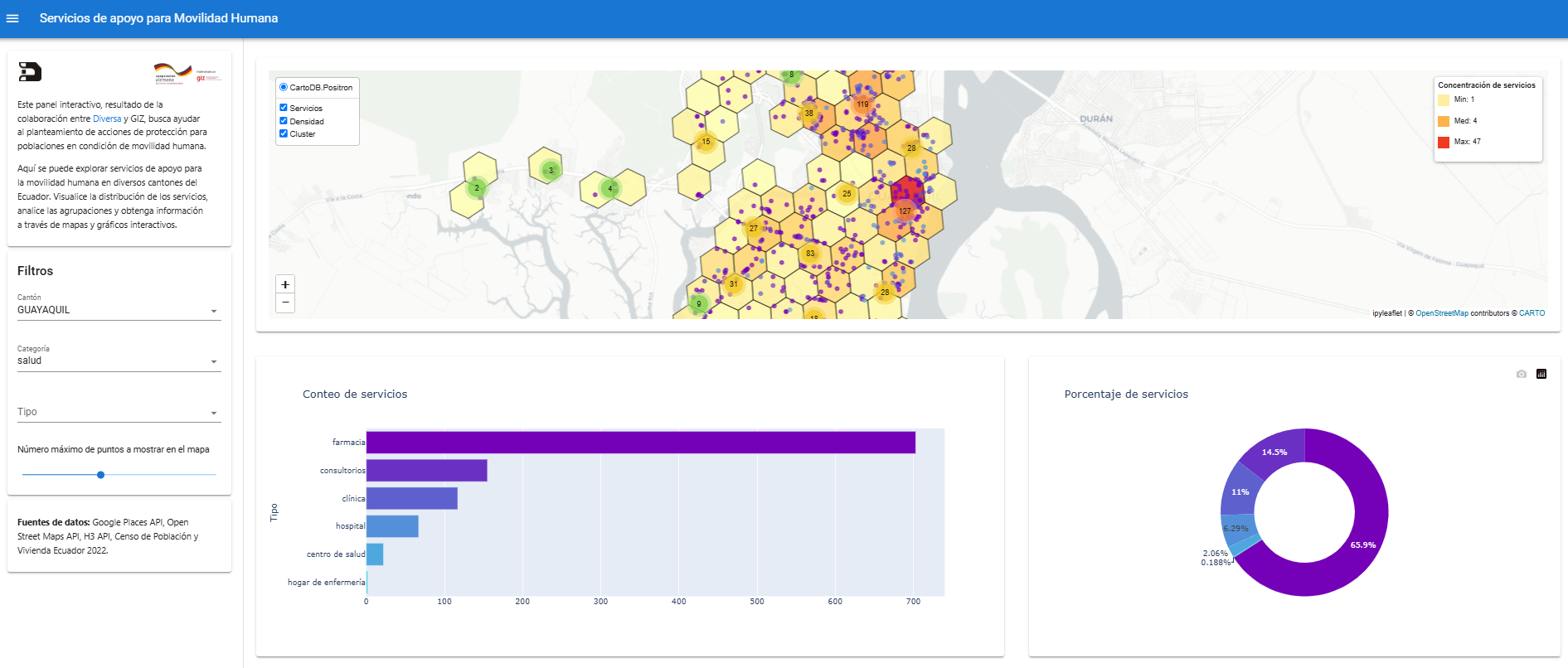
As part of the Sí-Frontera program, implemented by GIZ (German Cooperation), we implemented a comprehensive analysis for the visualization of support services available to people in a situation of human mobility in Ecuador. This initiative aimed to improve the understanding of the dynamics and needs of migrants and by mapping critical services along the routes. The project combined sociodemographic data analysis using ENEMDU (2022) and UNHCR statistics with extensive geospatial data collection through Google Places API and OpenStreetMap. This approach allowed for the identification and categorization of approximately 75,000 points of interest across multiple cities, organized into eleven essential service categories including transportation, healthcare, accommodation, and government services. A hexagonal indexing system (H3) was implemented to standardize statistical analysis across different urban areas.
A custom interactive dashboard was developed using Solara (Python) featuring mapping capabilities with multiple data layers, filtering options by city and service category, and cluster analysis to identify service concentration areas. This visualization tool enabled a clear understanding of service distribution patterns and highlighted gaps in coverage, particularly in border towns and along key migration corridors.