Open data collection methodology to understand public space in peripheral neighborboods
UDLA
Team: Diana Mosquera, Francisco Gallegos, Ana Medina
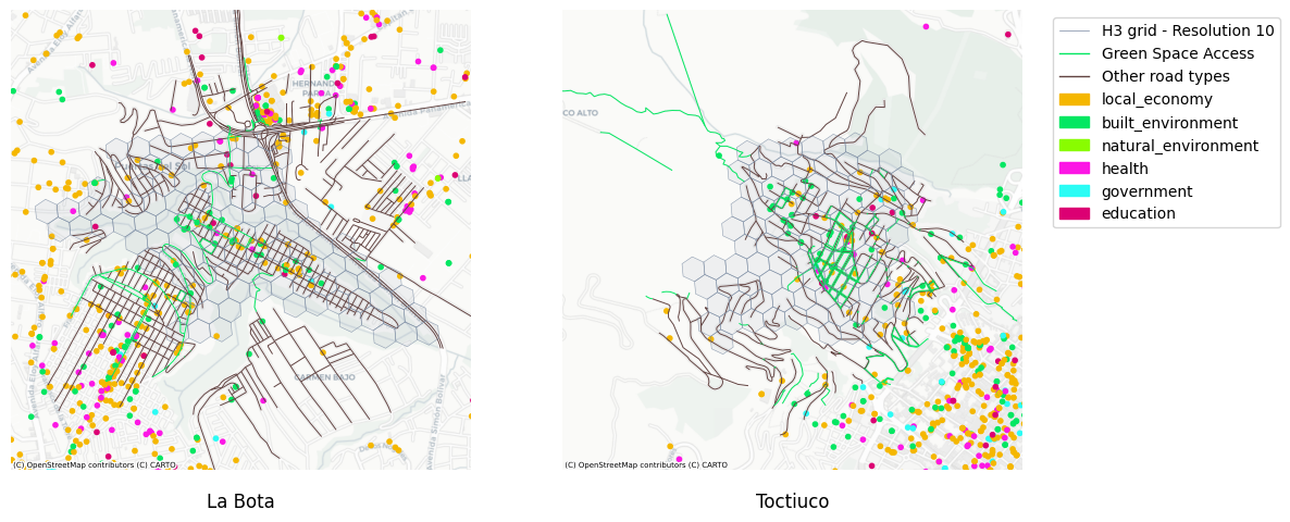
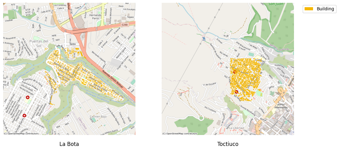
This research presents a methodological framework for collecting and analyzing geospatial data in peripheral neighborhoods where traditional open data sources are limited or outdated. Focusing on two low-income neighborhoods in Quito, Ecuador—La Bota and Toctiuco—the study develops techniques to assess public spaces, urban green areas, and support services that contribute to healthy urban environments. The methodology combines multiple data sources to overcome the limitations of restricted data access in informal settlements. Using Google Places API, Microsoft Planetary Computer, OpenStreetMap, and H3 hexagonal indexing, the research team created comprehensive spatial datasets that reveal the distribution of amenities, road networks, and building density. This integrated approach allows for standardized analysis across different urban areas, making it applicable to similar contexts in other cities.
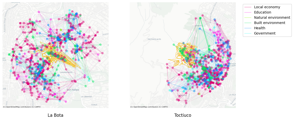
The analysis revealed that both neighborhoods suffer from limited accessibility to essential services, with many residents forced to travel outside their communities for daily needs. The study identified centralized patterns of service distribution that contribute to exclusion and segregation within these communities. Network analysis further demonstrated that while there may be numerous amenities in the vicinity, their spatial distribution often extends beyond neighborhood boundaries, highlighting accessibility challenges for residents.